東海道分間絵図 四
Measured Map of the Tōkaidō Road, Vol. 4

- 資料番号/Collection ID
- 86200764
- 大分類/Category
- 印刷物 / Printed Material
- 小分類/Sub Category
- 地図等 / Maps
- 種別/Type
- 絵図
- 作者(文書は差出人)
Creator - 遠近道印/作 菱川吉兵衛/画
- 発行所(文書は宛先)
Publisher - 万屋清兵衛/版
- 年代
Creation Date - 江戸中期 元禄16年 1703 18世紀
- 員数/Number
- 1帖/5帖
- 法量/Size
- 27.2 cm x 16.0 cm
関連
| 資料番号 Collection ID |
資料名 Object Name |
作者 Creator |
年代 Creation Date |
法量 Size |
||
|---|---|---|---|---|---|---|
| 1 | 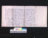 | 86200761-86200765 | 東海道分間絵図 Measured Map of the Tōkaidō Road | 遠近道印/作 菱川吉兵衛/画 | 江戸中期 元禄16年 1703 18世紀 | 27.2 cm x 16.0 cm |
| 2 | | 86200761 | 東海道分間絵図 一 Measured Map of the Tōkaidō Road, Vol. 1 | 遠近道印/作 菱川吉兵衛/画 | 江戸中期 元禄16年 1703 18世紀 | 27.2 cm x 16.0 cm |
| 3 |  | 86200762 | 東海道分間絵図 二 Measured Map of the Tōkaidō Road, Vol. 2 | 遠近道印/作 菱川吉兵衛/画 | 江戸中期 元禄16年 1703 18世紀 | 27.2 cm x 16.0 cm |
| 4 | | 86200763 | 東海道分間絵図 三 Measured Map of the Tōkaidō Road, Vol. 3 | 遠近道印/作 菱川吉兵衛/画 | 江戸中期 元禄16年 1703 18世紀 | 27.2 cm x 16.0 cm |
| 5 | | 86200765 | 東海道分間絵図 五 Measured Map of the Tōkaidō Road, Vol. 5 | 遠近道印/作 菱川吉兵衛/画 | 江戸中期 元禄16年 1703 18世紀 | 27.2 cm x 16.0 cm |